The Faroe Islands are volcanic. They were built during a period of a few million years, some 55 million years ago, in early Paleogene times, when Europe and Greenland started to separate, opening up what became the Northeast Atlantic Ocean. Countless numbers of volcanic eruptions built up a huge basalt plateau that covered almost the entire Faroe-Rockall region, together with the south-eastern part of Greenland. In simple terms, each basalt lava flow of to-day’s Faroe Islands represents one volcanic eruption during that time period.
Some volcanic eruptions produced voluminous sheet flows each with a thickness of several tens of meters and covering hundreds of square kilometres. Others built up compound lava flows each composed of several thin basalt layers. Some eruptions were violent and produced large volumes of volcanic ash that can be found in between the lava flows. Other strata between the basalt layers contain volcaniclastic and other sediments that bear witness of long time periods in between each of the eruptive events, with rich vegetation in a sub-tropic climate, and with local erosion or deposition of sediments in rivers and shallow lakes.
One volcanically silent time period was especially long standing and resulted locally in the deposition of several sedimentary layers of various composition, including strata rich in organic material that subsequently have generated considerable volumes of coal. In recent times the coal has been worked from mines in between the basalt flows near the northern villages of Suðuroy.
With the plate tectonic evolution, the Faroe Islands have slowly moved away from the active volcanic region, which to-day is concentrated in Iceland and along the Mid Atlantic Ridge. Meanwhile, the Faroe-Rockall Plateau has by and large subsided beneath the sea level while erosive forces – especially during the last few million years of alternating glacial and interglacial periods – have sculpted the landscape to the present-day islands.
The overall thickness of volcanic and intervening rock layers of the Faroe Islands is more than 6 km, of which only the upper half is located above the present sea level. The remaining part has been drilled in a 3½ km deep well in Lopra, Suðuroy.
The overall rock pile has been subdivided into seven stratigraphic formations. From bottom to top these constitute the following:
Lopra Formation is only known from the lowermost 1,100 m of the Lopra well. It constitutes a mixture of various volcaniclastic rocks, lavas and sills.
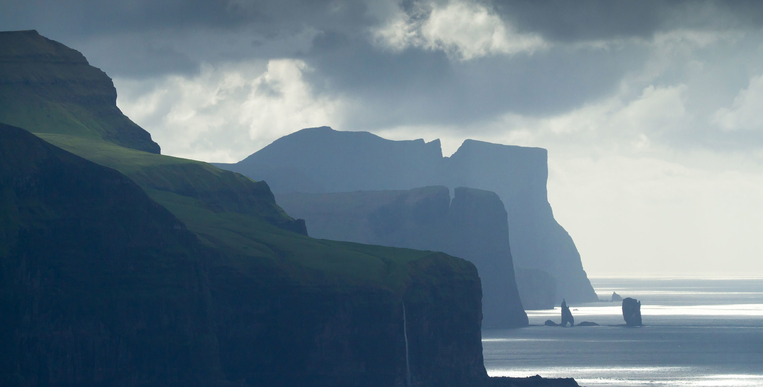
Beinisvørð Formation is partly found in the uppermost 2.3 km of the Lopra-1 well, while the uppermost 900 m of this formation covers most of the island of Suðuroy, the entire Mykines, and the westernmost part of Vágoy. It constitutes mainly thick and voluminous basalt sheet flows with intercalated sediments, including small coal seems. Beinisvørð is the name of a scenic, almost 500 m high cliff in the southernmost part of Suðuroy.
Prestfjall Formation is the only non-volcanic sedimentary formation of the islands. It is up to 15 m thick and was previously termed the coal-bearing sequence. It crops out in several places in the northern regions of Suðuroy, western Vágoy, and on the islet of Tindhólmur. A coal mine is still active in the mountain of Prestfjall, south of the village of Hvalba.
Hvannhagi Formation is up to 50 m thick, and it represents the most violent phase of eruption in the Faroe Islands, including voluminous ash-falls and landslide units. It is composed of basaltic tuffs and different volcaniclastic sediments. It covers the area between the villages of Hvalba and Froðba in northern Suðuroy, including the scenic coast region of Hvannhagi.
Malinstindur Formation has its name from a mountain on Vágoy. It is 1,400 m thick and is mainly composed of numerous compound lava flows with only minor intercalated sedimentary units. This formation covers the northernmost part of Suðuroy in addition to large parts of the central islands of the Faroe Islands.
Sneis Formation contains a laterally extensive, maximum 30 m thick sandstone and conglomerate sequence, the base of which marks a major hiatus in the volcanic activity. Within this formation is also a distinct series of basalt lava flows with a maximum combined thickness of 50 m. The formation is present on many of the islands, except on Suðuroy, Mykines, Vágar, Svínoy and Fugloy. The mountain Sneis is located centrally on Streymoy.
Enni Formation, which has its name from a mountain near the village of Hvannasund, Viðoy, has a thickness of 700 m. It consists of various basaltic compound and sheet flows, interbedded with volcaniclastic and other sedimentary units, some of which are several meters thick and have been found on Nólsoy. The formation covers most of the central and eastern parts of the Faroe Islands.